

Editors Note: This is the fourth piece of a recurring series where the Tribune explores little known historical gems within Matagorda County.
Long before maps or county lines, this fertile strip of Gulf Coast was home to the Karankawa people, a coastal Native American group whose name became synonymous with the region.
Contrary to early European accounts — which wrongly branded them as cannibals and savages — the Karankawa were skilled fishers, hunters, and navigators of the bayous and rivers that lace the Texas coast.
Seasonally nomadic, the Karankawa moved between the barrier islands in the summer and inland estuaries in winter.
They fashioned canoes from dugout logs and made extensive use of the area’s rich marine life — shrimp, oysters, sea turtles, and redfish.
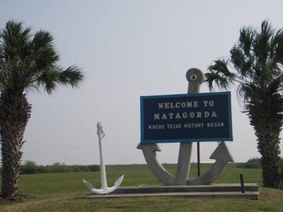
The name “Matagorda,” meaning “thick bush” or “dense brushwood” in Spanish, likely references the coastal vegetation that provided the Karankawa with cover and sustenance.
The earliest European records of the region stem from the late 17th century, when Spanish explorers scouted the Gulf Coast to defend New Spain from French encroachment.
In 1685, the French explorer La Salle landed at Matagorda Bay, mistakenly believing he had reached the mouth of the Mississippi River. His ill-fated colony, Fort Saint Louis, located west of present-day Matagorda County in what is now Victoria County, brought catastrophe for both settlers and natives.
Alarmed by French presence, Spain began launching expeditions along the Texas coast.
In the early 1700s, Spanish missionaries and soldiers ventured into the Matagorda region, attempting to Christianize the Karankawa and establish missions.
These efforts largely failed — beset by disease, flooding, and resistance from the indigenous population.
The land remained largely under native control throughout the 18th century, a liminal space between empires and cultures.
The turning point came in 1821, the year Mexico gained independence from Spain and granted Stephen F. Austin permission to settle 300 families — what would become known as the Old Three Hundred — in what was then a remote Mexican territory.
Austin quickly recognized the strategic value of Matagorda Bay as a port. Its access to the Gulf of Mexico and proximity to the mouth of the Colorado River made it an ideal location for trade, supply, and security.
His colonists, largely from southern U.S. states like Kentucky, Tennessee, and Louisiana, brought with them enslaved labor, agricultural knowledge, Protestant faiths, and a desire to recreate a familiar Southern lifestyle on unfamiliar land.
In 1827, the town of Matagorda was formally established near the river’s mouth.
It became a key port of entry for goods, people, and mail.
The land was fertile and water plentiful, ideal for growing cotton, corn, and sugarcane.
By the 1830s, Matagorda had become one of the largest and most prosperous settlements on the Texas coast.
The outbreak of the Texas Revolution in 1835 brought turmoil to the coastal settlements. Matagorda’s men took up arms and fought at key battles such as San Jacinto. The community’s port and resources supported the Texian cause.
When Texas declared its independence in 1836, the newly formed Republic of Texas created Matagorda County as one of its original 23 counties.
The county initially encompassed a large area stretching along the Gulf and inland, framed by the Colorado River.
Matagorda town served as the county seat and remained one of the region’s most influential port cities for the next several decades.
As part of the Republic and then the State of Texas (after annexation by the U.S. in 1845), Matagorda County expanded its economic base, building rail lines, shipyards, and cotton gins.
Antebellum plantation agriculture, heavily reliant on enslaved African Americans, dominated the landscape, especially along the river and bayous.
The American Civil War (1861–1865) brought devastation to the region. Though Texas had seceded and joined the Confederacy, its coastline was vulnerable to Union blockades.
Matagorda Bay, once a thriving port, was choked off by Union naval patrols. Federal ships often entered the bay and launched raids, burning crops, seizing cotton, and disrupting Confederate supply lines.
After the war, Matagorda County — like much of the South — faced the painful transition through Reconstruction.
The collapse of slavery upended the plantation economy, and many formerly enslaved people remained in the area, becoming tenant farmers or laborers.
The late 19th century was marked by economic instability, racial violence, and political tension, but also by resilience.
Schools were rebuilt, churches reestablished, and communities reformed themselves in a new social order.
Matagorda, despite its historical significance, suffered a series of crippling blows in the late 1800s. Hurricanes in 1854, 1875, and 1886 devastated the low-lying coastal town.
The 1875 hurricane, in particular, was catastrophic, leveling homes and drowning livestock.
Combined with the increasing inland pull of commerce and population, civic leaders decided to relocate the county seat.
In 1894, the newly established inland town of Bay City (so named for its proximity to Matagorda Bay) became the county seat.
Built on higher ground and served by new rail lines, Bay City quickly became a center of commerce, education, and local government.
The early 20th century brought transformation.
Rice farming, introduced with irrigation systems from the Colorado River, became a major industry.
Cattle ranching expanded across the prairies, and sulfur and oil discoveries in the 1920s and 1930s led to new towns, jobs, and infrastructure.
World Wars I and II pulled young men from Matagorda into service, while bringing military investment and industrial development to the region.
The Celanese chemical plant, opened in the 1940s, and later power plants in the 1970s, added new dimensions to the county’s economy.
After 1970, Matagorda County entered a new phase of economic and social transformation, shaped largely by developments in energy infrastructure, environmental awareness, and shifting demographics.
While the county had long been rooted in agriculture and maritime commerce, the late 20th century brought a surge in industrial growth — especially in energy production and chemical manufacturing
One of the most significant developments was the construction of the South Texas Project Nuclear Generating Station near Wadsworth.
Completed in the 1980s, it became one of the largest nuclear power plants in the United States and a major employer in the region.
The plant not only bolstered the local tax base but also catalyzed improvements in infrastructure.
This economic growth also led to an increase in population, as well as a wave of focus from outside companies looking to Matagorda as a place with potential.
At the same time, Matagorda County began to reckon with its fragile ecological balance. The rich estuarine ecosystems of Matagorda and East Matagorda Bays faced growing pressure from industrial runoff, dredging, and overdevelopment. Conservation efforts gained momentum in the 1980s and 1990s, spurred by both local activists and national environmental organizations. The creation of the Matagorda Bay Nature Park, the Mad Island Marsh Preserve, and the Colorado River Refuge reflected a broader commitment to balancing economic development with environmental stewardship.
Culturally, the county saw changes as well. The growing Hispanic population, which had deep roots in the region since the 19th century, became more prominent in civic life, business, and education. Agricultural labor continued to depend heavily on migrant and seasonal workers, many of whom eventually settled permanently in the area, contributing to a rich bilingual, bicultural community.
Education also underwent modernization, with school districts consolidating and improving facilities. The Bay City Independent School District expanded its vocational programs to serve a more technically skilled workforce, aligning with the demands of the energy and manufacturing sectors. The growth of the Wharton County Junior College extension campus in Bay City also provided local access to higher education and technical training.
By the dawn of the 21st century, Matagorda County stood at a crossroads between its deep historic roots and a future shaped by industry, conservation, and cultural diversity. Hurricanes and tropical storms—including Tropical Storm Allison (2001) and Hurricane Harvey (2017)—continued to test the resilience of coastal infrastructure and communities, but rebuilding efforts reflected a strong spirit of endurance.
Today, Matagorda County remains an emblem of the Texas Gulf Coast.
Kavan Van Hal has a history degree and put this article together with the help of the Texas General Land Office Archives, the Matagorda County Historical Commission, TSHA Online (Texas State Historical Association), and primary materials including the diaries of Mary S. Austin and early settlers. Additional insights were drawn from Matagorda County: A Historical Portrait by R.E. Holman and U.S. Census and Agricultural Reports from 1850 to 1920.


(0) comments
Welcome to the discussion.
Log In
Keep it Clean. Please avoid obscene, vulgar, lewd, racist or sexually-oriented language.
PLEASE TURN OFF YOUR CAPS LOCK.
Don't Threaten. Threats of harming another person will not be tolerated.
Be Truthful. Don't knowingly lie about anyone or anything.
Be Nice. No racism, sexism or any sort of -ism that is degrading to another person.
Be Proactive. Use the 'Report' link on each comment to let us know of abusive posts.
Share with Us. We'd love to hear eyewitness accounts, the history behind an article.